I did some research on ancient maps to look at their aesthetics and visual details.
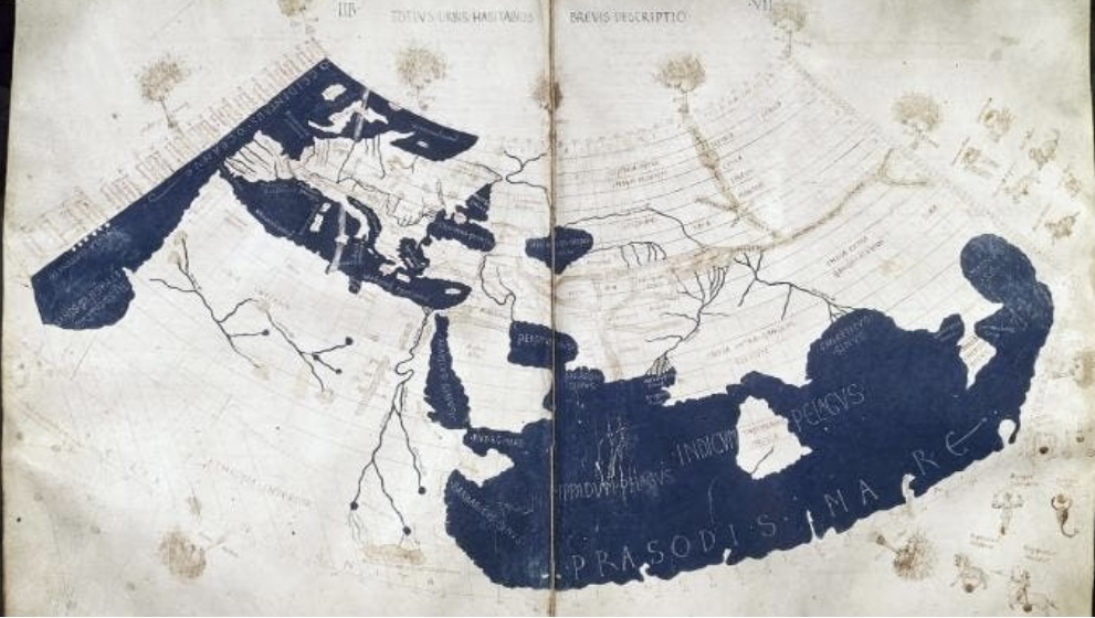
Ptolemy’s Geography. Below is a Medieval reconstruction of one of Ptolemy’s Maps ( credit: public domain”, image via http://www.history.com).
Below is The Tabula Rogeriana or a “A Guide to Pleasant Journeys into Faraway Lands.” (credit: public domain, image via http://www.history.com).
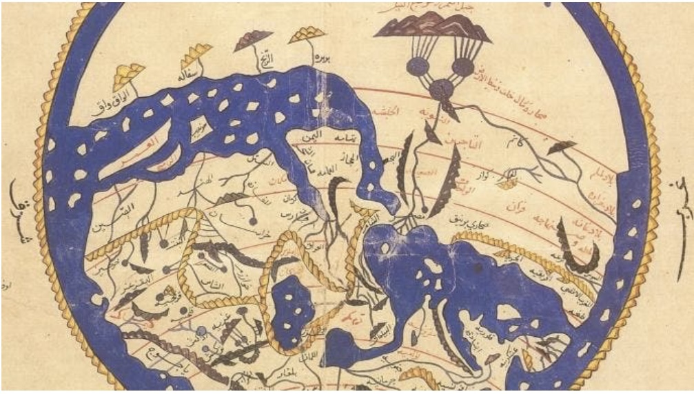
court of the Norman King Roger Il and asked
to produce a book on geography.
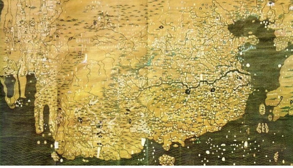
Below is a map by Da Ming Hun Yi Tu ( credit public domain, image via http://www.history.com).
Early Japanese maps of the world.
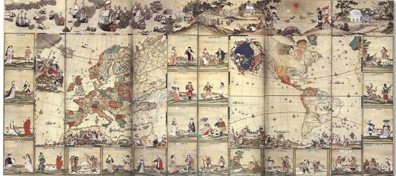
Above is a Continental Map with Scenes of Forty-Eight Foreign People (America and Europe), late 18th century, manuscript ( a pair of six-fold screens), Kobe City Museum; image via http://www.myoldmaps.com;
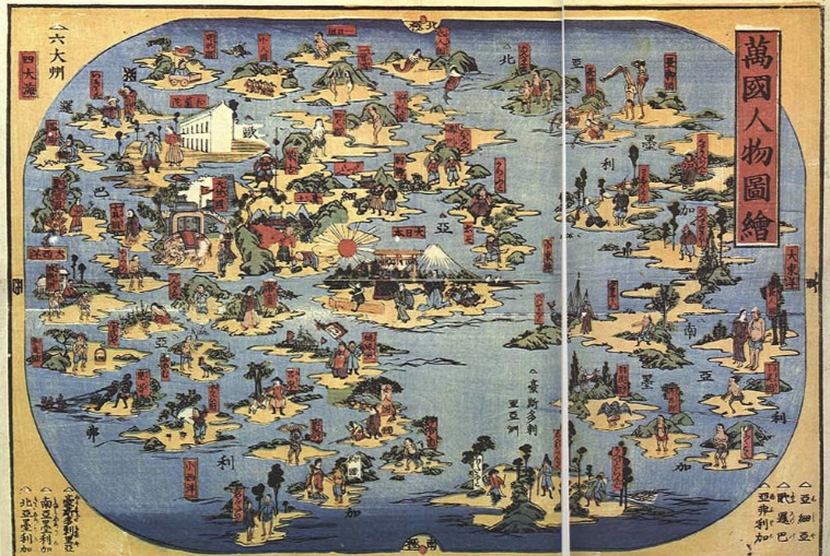
Bankoku Jinbutsu Zue (Map of the World), 1850, woodcut, 33*48,5 cm, image via http://www.myoldmaps.com; above

Gotenjiku-Zu (Map of the Five Indies), 1744, 167.5*134 cm, image via http://www.myoldmaps.com; above
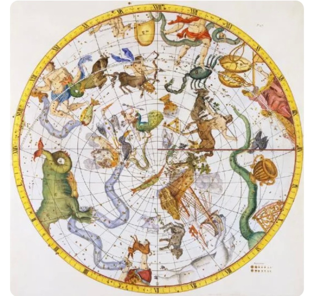
Below is a “27 Nakshatras map” in Hindu astrology system. Author unknown, Image from open public resources, http://www.ganeshaspeak.com;
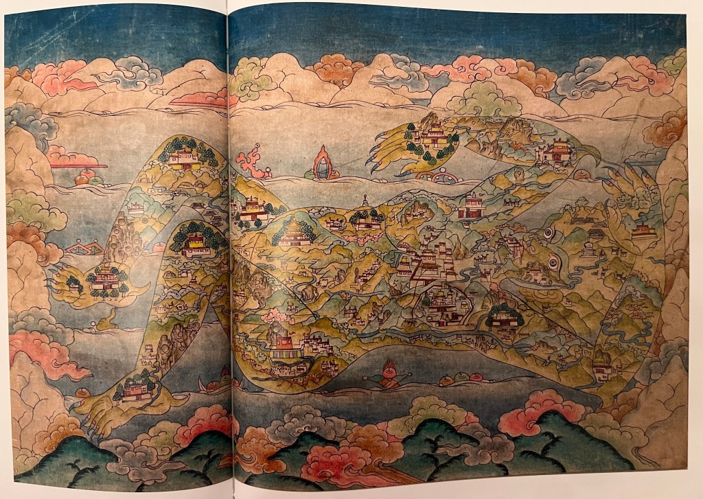
Below is a Map of Tibet, XX century, mineral pigments on cotton, Collection of the Rubin Museum, image via “Tresors du Tibet”by Etienne Rock, Jean-Marc Falcombello, Magali Jenny, Flammarion, Paris, 2022;
Bibliography: “Early Japanese Maps of the World”, online on http://www.myoldmaps.com; [accessed on April 10th 2023];”8 Remarkable Early Maps”, Evan Andrews, August 223, 2018, online on http://www.history.com; [accessed on April 10th, 2023]; Tresors du Tibet”by Etienne Rock, Jean-Marc Falcombello, Magali Jenny, Flammarion, Paris, 2022;
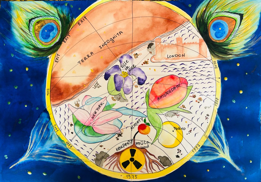
Even though we didn’t have an exercise to draw a map, I made some sketches in map drawing visual approach. I really liked the round maps, blue hues and shades, as well as a design for mapping the seas. On my Map I placed cities I visited and lived in, which became significant in my life. Map drawing resonated with my interest in symbolic paintings, so I worked on designing and thinking about symbols, which could work for the map drawing and designate the important events of my life.
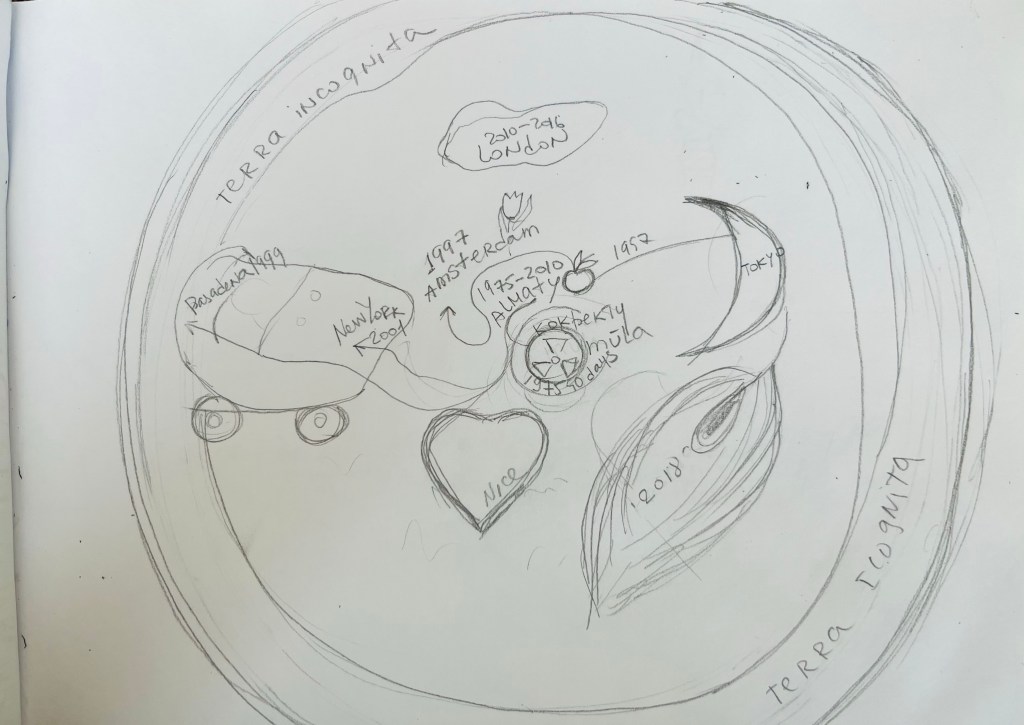
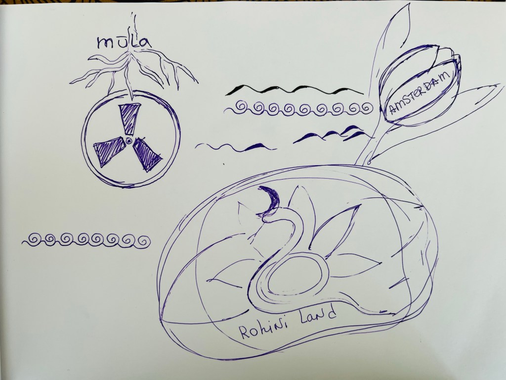
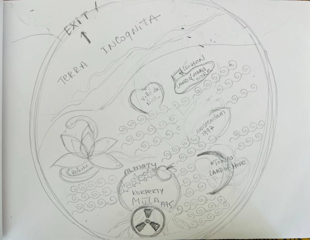
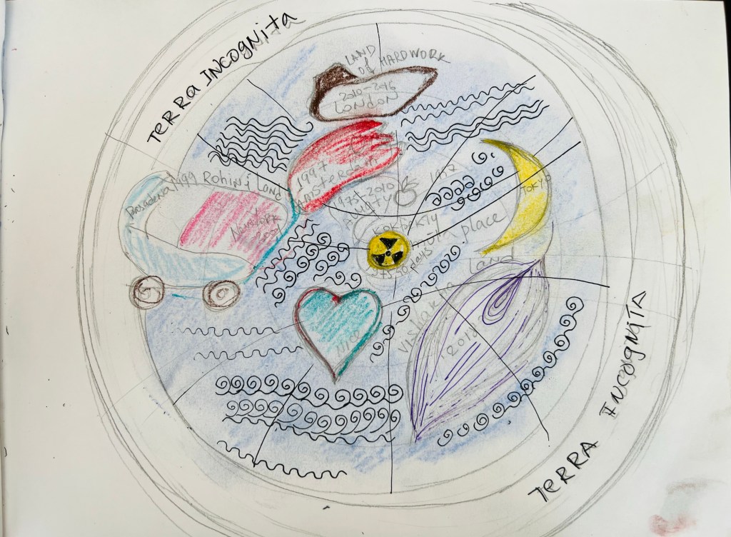
The outcome as a map appeared different from the sketches. At the bottom, I placed “1975”- my birth year. I was born in Eastern Kazakhstan, near the Semey region – a place known as a Soviet nuclear weapon testing site. Also, the atomic energy sign connects well with Nakshatra by birth (an astrological term for Moon’s position at the time of native’s birth), called “Mula” Nakshatra. The Mula Nakshatra is associated with roots and powerful, intense energy coming from the centre of our Galaxy- the Milky Way. Thus for these reasons above, I placed a symbol for nuclear power danger and a drawing of a bunch of roots. I put the word “EXIT” in the upper right corner, which means the end of life. The large part of the map I named as “Terra Incognita”- a Latin saying about unknown land. The peacock feathers symbolize my Faith and spiritual aspiration, my hope for my Soul’s liberation after death. The visual language of my drawing was determined by the elements I found in the maps above:
- The mythological and spiritual symbols
- Overall shape
- The colours for the map surface and around it
- Littles signs for the sea areas and islands
- The black lines over the map